



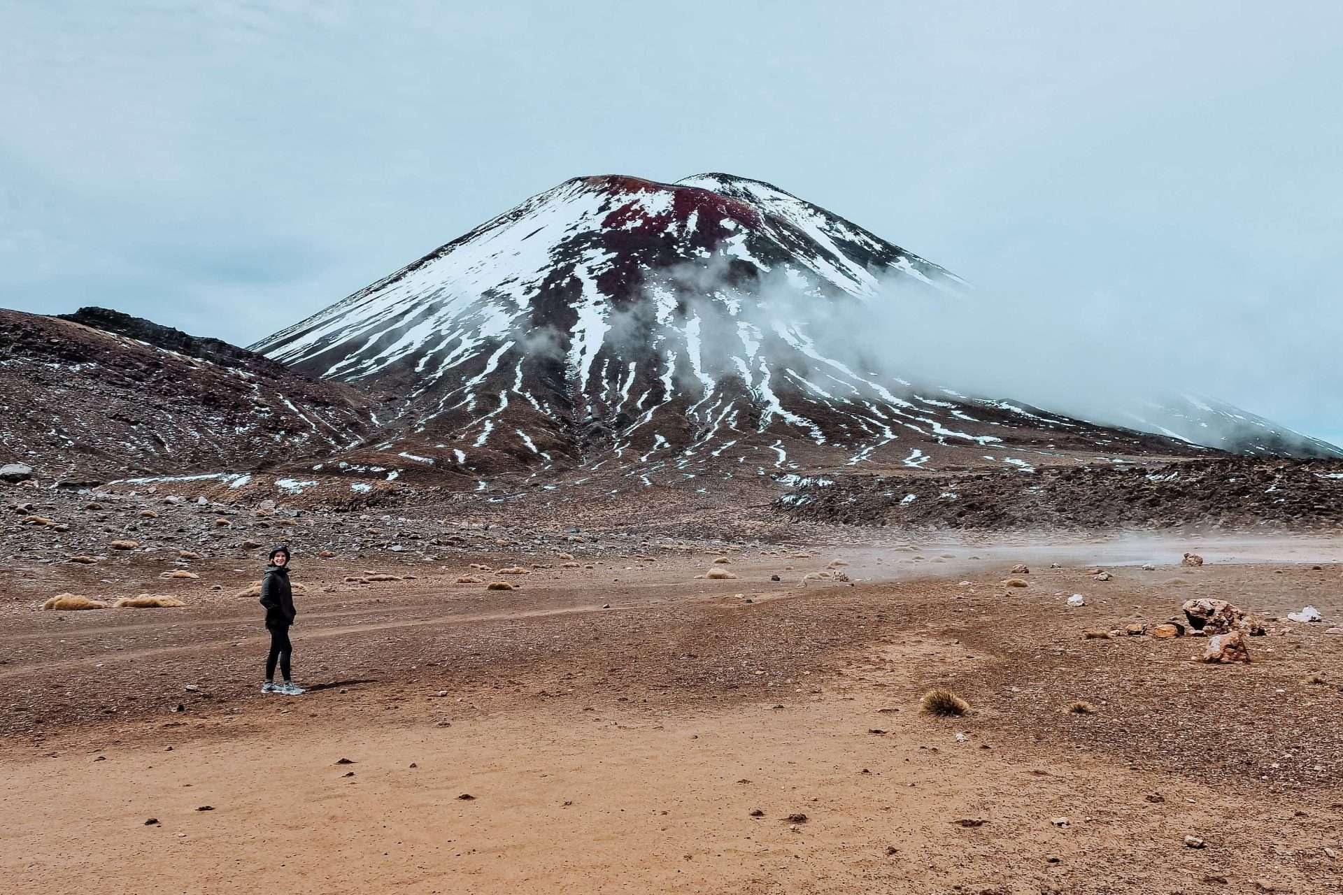
The Tongariro Alpine Crossing is considered by many to be New Zealand’s most beautiful day hike. It’s even ranked among the top 10 most beautiful day hikes in the world. We ventured out on this renowned hike through the rugged volcanic landscape and can only agree. This eight-hour hike takes you through diverse landscapes and past no fewer than three active volcanoes. One moment you’ll feel like you’re in the *Lord of the Rings* trilogy; the next, you’ll feel as if you’ve landed on the moon. The hike is often underestimated, which is why we’re happy to tell you everything about the Tongariro Alpine Crossing in New Zealand so you can set out well-prepared!
Where is the Tongariro Alpine Crossing located?
The Tongariro Alpine Crossing is located on New Zealand’s North Island, specifically in Tongariro Alpine National Park. From Wellington it is about a 4-hour drive to the national park and from Auckland it is about 4.5 hours. New Zealand’s roads cannot be compared to those in Belgium or the Netherlands. Therefore, it often takes you a little longer than indicated. The winding roads and many hairpin turns will take you past the rugged landscape New Zealand is so famous for, but rest assured that driving here is certainly not a punishment.
We do recommend splitting your route into two parts. Coming from Auckland, you can make a stopover in Rotorua which is best known for its geothermal springs. Coming from Wellington, you can stop off in Napier, one of the best wine regions in New Zealand. Read in advance our ideal travel route through the North Island for more inspiration.

Where to stay for the Tongariro Crossing?
Tongariro Alpine National Park is about an hour’s drive from Lake Taupo, New Zealand’s largest lake. Here you will find several campsites or hotels to stay in nearby. In the national park itself, accommodations are limited. So it is definitely advisable to record this in advance. If you travel by RV, you can use apps such as Campermate or Rankerz to see which campgrounds are nearby. We ourselves stayed at the campsite Tongariro Holiday Park which is just a 5-minute drive from the start of the hike. There are also several lodges around the national park where you can stay such as the Creel Lodge or Braxmere Lodge.
Everything you need to know before you start the hike
The Tongariro Alpine Crossing in New Zealand is a tough 19.4-kilometer hike in which you conquer 841 meters of altitude. In this, you walk from point A to point B, so you do not make a circle. The hike used to be called the Tongariro Crossing, but a few years ago they changed the name to the Tongariro Alpine Crossing. This is to give people a better understanding of the walk. In fact, you will enter alpine territory with this hike, which means it can be very cold here. Therefore, it is strongly recommended that you dress very well. Dress in layers, that way you can always adjust to the temperatures throughout the day. It is especially cold at the summit, where there is often a strong wind as well. Also make sure you have appropriate hiking shoes with adequate grip, since you will be hiking over rough ground.
Parking at the Tongariro Crossing
Since you are hiking from A to B and not making a loop, it is obviously important to get back to your RV or car after the hike. The most practical way is to book a shuttle. On the hike you will find two parking lots, the Mangatepopo parking lot at the beginning and the Ketetahi parking lot at the end of the hike. Park your car in the Ketetahi parking lot and take the shuttle from here to the start of the hike. This way, you can then hike back to your car or camper via the Tongariro Alpine Crossing at your own pace. You can easily book the shuttle online which again we recommend doing in advance. Shuttles leave three times a day in the morning.
What do you take with you on your hike in New Zealand?
We are in a national park, so you won’t find anything to eat or drink here. So be sure to bring plenty of your own drinks and food (at least 1.5 liters of water per person). After all, you are on the road all day. When you put the following items in your daypack, you will be well prepared to start your hike:
- Sufficient food and drink
- Waterproof and windproof jacket and fleece sweater
- Hat and gloves
- Sunglasses and sunscreen
- Walking sticks (optional)
- A map of the area (can be found locally or offline via Maps.me)
What in case of bad weather?
We’ve experienced firsthand that the weather in New Zealand can be very changeable. For this reason, hiking the Tongariro Alpine Crossing is not recommended in bad weather. In such cases, the shuttles are canceled. In bad weather, it may be too dangerous to do the hike, so always keep in mind the possible risks. Also, the view is only limited by the cloud cover so you won’t see much of the beautiful scenery. Try to keep an eye on the weather in advance and plan your schedule accordingly. That way you will have the best experience with this hike.
Of course, you only have a limited number of days to spend in this amazing country, and you can’t always wait for good weather. If the weather is bad but you still want to venture out on this hike, you can always park your car in one of the two parking lots. The hike is well marked, and you can then hike to the halfway point which is about to the top. This way you can enjoy the best view of the entire hike. Then you can return to your transportation by the same route. If you have several days, you can park your car in the other parking lot the next day and do the second half of the hike.
The Tongariro Alpine Crossing from start to finish
The weather is with us and the shuttles are running? Dressed well and brought plenty of drinks and food? Way to go! Then it’s time to start our 19.4-kilometer trek. The hike is very well signposted throughout the park. Since this is a popular hike, you will also never be completely alone. So getting lost will not happen!

South Crater
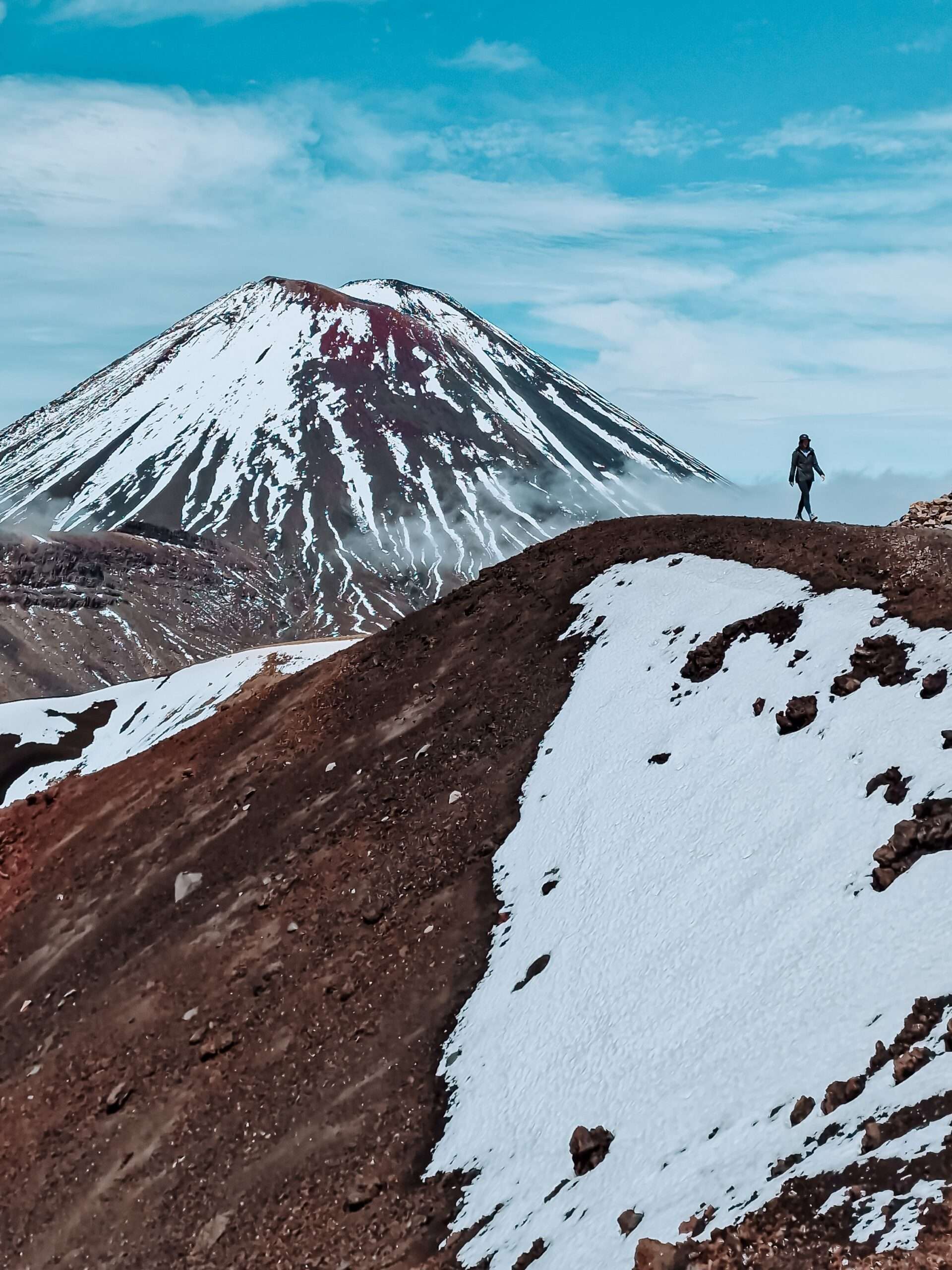
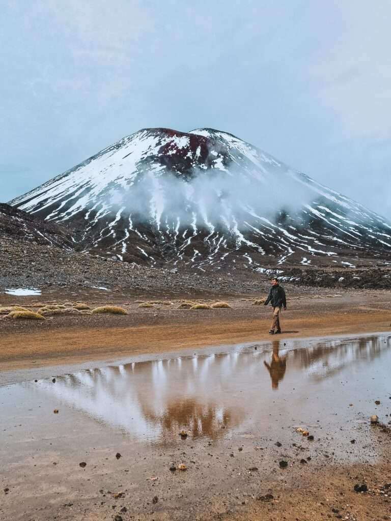
The first few miles of the hike are the easiest and generally flat. Via a wooden bridge, you walk along a volcanic landscape until you reach Soda Springs. During this stretch, you already have stunning views of the volcano Ngauruhoe, better known as Mount Doom from Lord of the Rings.
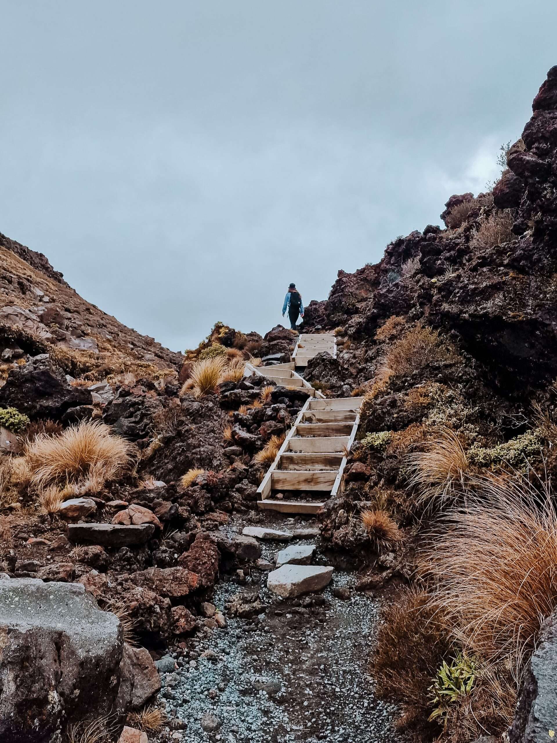
Then begins the difficult part of the hike where you overcome a lot of altimeters over a short distance. This section is not called the “Devils Staircase” for nothing and is not to be underestimated. Several signs along the hike also indicate this with texts such as “It’s not too late to turn back! Slowly you climb up, with Mount Ngauruhoe always in your line of sight, until you reach the first milestone of the hike: the South Crater.
Red Crater
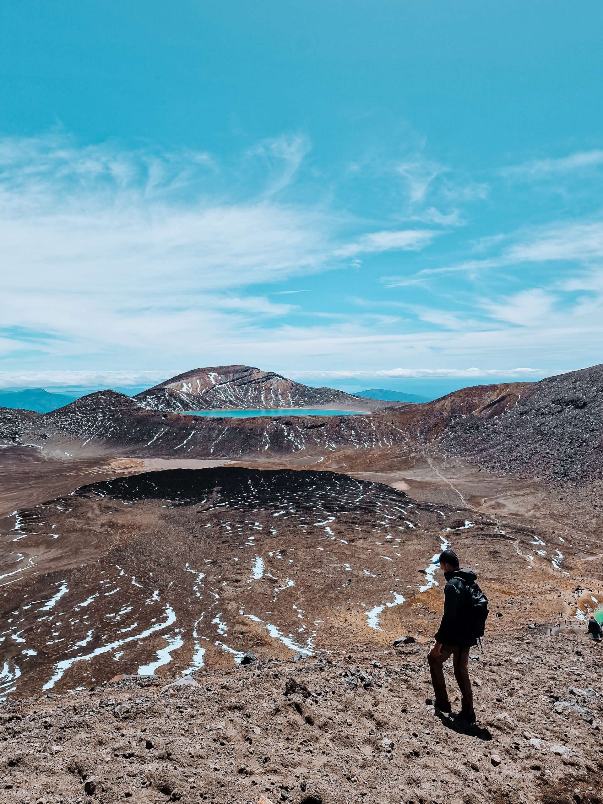
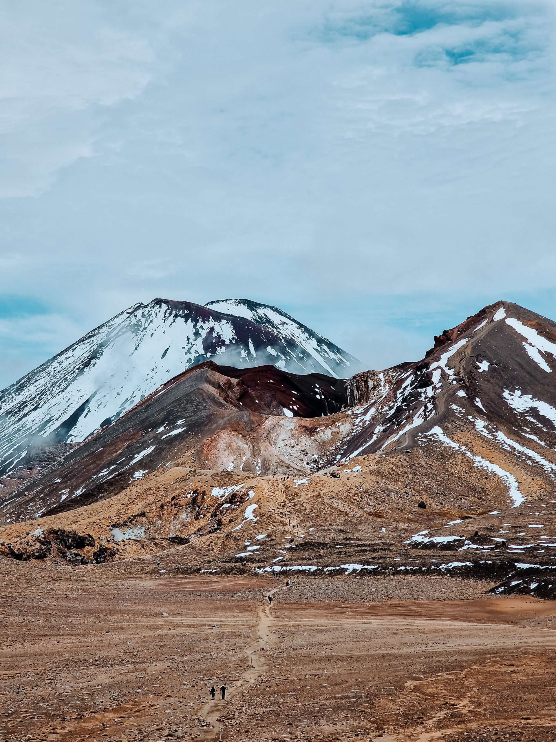
Enjoy the stunning views of Mount Ngauruhoe, and then continue climbing to the literal highlight of the hike: the Red Crater at 1886 meters above sea level. This stretch is also not to be underestimated and can be extra challenging due to the strong, cold wind blowing on the ridge. But you will be rewarded with phenomenal 360° views, with the impressive Mount Ngauruhoe on one side and the Central Crater and Emerald Lakes on the other. What makes it even more exciting is knowing that you are hiking along one of the most active volcanoes in the world. This is also indicated along the hike with signs such as “Eruptions can always happen without any warning.”

Emerald Lakes
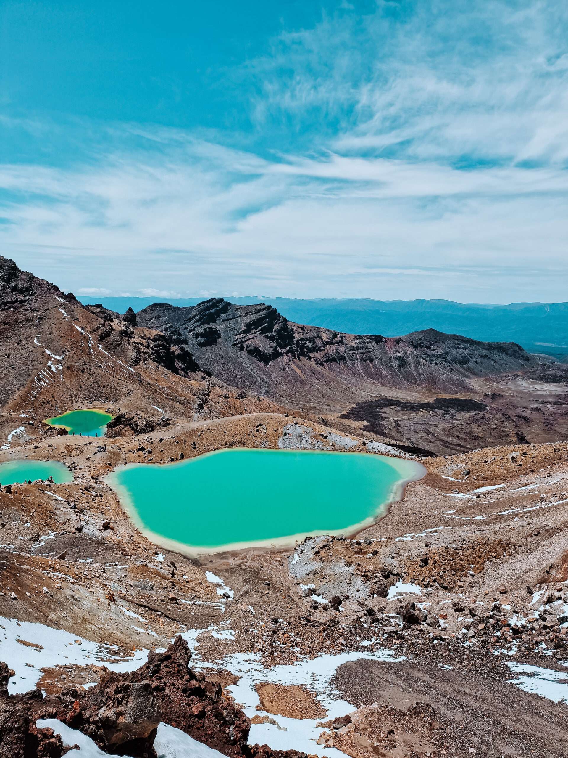
Continue your hike by descending into the loose sand toward the Emerald Lakes. This descent is short but steep, and the loose sand does not always make it easy. Once at the Emerald Lakes, this is the perfect place to enjoy that well-deserved lunch while overlooking the emerald lakes in a vast lunar landscape. Then we continue this beautiful trip toward Blue Lake. A refreshing swim is out of the question, though, because this deep blue crater lake is filled with acidic water. Once again enjoy this unique landscape before beginning the 9-kilometer descent. During this descent, you have a beautiful view of Lake Taupo and walk the last part through a forest.

Once you arrive at the Ketetahi parking lot, you will be exhausted but feel great at the same time. You’ve just completed a hike of nearly 20 kilometers and you’ve done steep climbs, tough descents and maybe even in the craziest weather conditions. Be sure to schedule a rest day the next day because you may feel it in your legs. But you will always look back on a great day, because you just walked one of the most beautiful day hikes in the world. Want to know more about Tongariro National Park? You can read about that here!
Do you have any questions about the Tongariro Alpine Crossing? Let us know in a comment below! Looking for more information about your next trip? Please do not hesitate to contact us or send an email to info@snoezelsontheroad.com
this article is very useful, thank you for making a good article